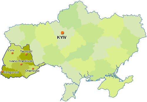
Carpathian Region of Ukraine
Transcarpathian, Ivano-Frankivsk, Lviv, Ternopil, Chernivtsi Regions
Transcarpathian Region
(formed in 1946)
Regional center:
Uzhhorod
Area: 12.8 thous. sq. km
Population: 1,202,000 inhabitants
Geographical location: situated in the southwest on the junction of the borders of Ukraine and four neighboring countries: Romania, Hungary, Slovakia and Poland. The mountains cover almost 60% of the territory.
Administrative division: 13 districts. Uzhgorod and Mukachevo are the biggest cities.
Ivano-Frankivsk Region
(formed in 1939)
Regional center:
Ivano-Frankivsk
Area: 13.9 thous. sq. km
Population: 1,373,000 inhabitants
Geographical location: divided into three distinct relief types: plain (Podilska Hills), pre-mountain (Precarpathian), and mountain parts. 50% of the territory is covered by the mountains.
Administrative division: 14 districts. Ivano-Frankivsk, Kalush, Kolomyia, Dolyna, Nadvirna are the biggest cities.
Lviv Region
(formed in 1939)
Regional center:
Lviv
Area: 21.8 thous. sq. km
Population: 2,668,000 inhabitants
Geographical location: the northern part of the region lies within Volyn hill, Male marshy woodlands and Podilska Hills separated by the Dniestr River from Precarpathian. On the southern west there are situated the ridges of the Ukrainian Carpathians (Beskydy, Stryisko-Sanska hill, Verkhovynskyi watershed ridge).
Administrative division: 20 districts. Lviv, Drohobych, Stryi, Chervonograd, Boryslav, Sambir are the biggest cities.
Ternopil Region
(formed in 1939)
Regional center:
Ternopil
Area: 13.8 thous. sq. km
Population: 1,151,000 inhabitants
Geographical location: it is situated in the forest-steppe zone (forests cover 190,3 thous. hectares). Almost the whole territory is covered by the Volyn Hills, where the Kremenetsky mountains and the Tovtry are located. On the extreme northern west there is a plain of Male marshy woodlands.
Administrative division: 16 districts. Ternopil, Chortkiv, Kremenets are the biggest cities.
Chernivtsi Region
(formed in 1940)
Regional center:
Chernivtsi
Area: 8.1 thous. sq. km
Population: 914,000 inhabitants
Geographical location: it is situated in the Precarpathian zone and the eastern part of the Ukrainian Carpathians. The plain part of the region is occupied by the Khotynska Hills. In the southwest there are situated the Pokutsko-Bukovynsky Carpathians and some small ranges.
Administrative division: 10 districts. Chernivtsi, Storozhynets, Sokyriany, Khotyn are the biggest cities.
 to the top
|

